In 1964, as millions of visitors prepared to descend on New York City for the 1964/65 World’s Fair, the National Geographic Society published a Manhattan Tourist map. We, as ocean liner enthusiasts, are fortunate that the mapmaker opted to include accurate, detailed renderings of all the North River piers.
Have you ever wondered where your favorite liner docked in New York in 1964? Well, you’ll find the answer here. Cunard Line, United States Lines, Italian Line, French Line, Holland America Line, and all the rest. The map freezes a moment in time just before the great falloff in transatlantic ocean liner traffic.
Below are three map views. The first view shows the “newer” northern piers, which were built beginning in the 1930s to accommodate the era’s larger liners and where most liners and cruise ships continued to dock until the late 20th century. The second map view shows lower Manhattan’s historic 19th and early 20th century piers. Pier 59, for instance, is where Titanic (1912) was scheduled to dock. Pier 54 was the final port call for Lusitania (1907). The third map view shows the entire line of North River piers, as well as many piers on the East River as well as on the shores of Brooklyn and New Jersey.
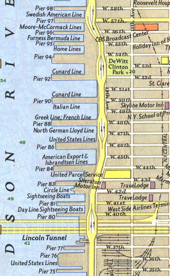
Map Detail North.
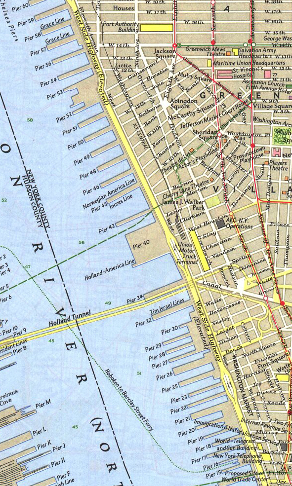
Map Detail South.
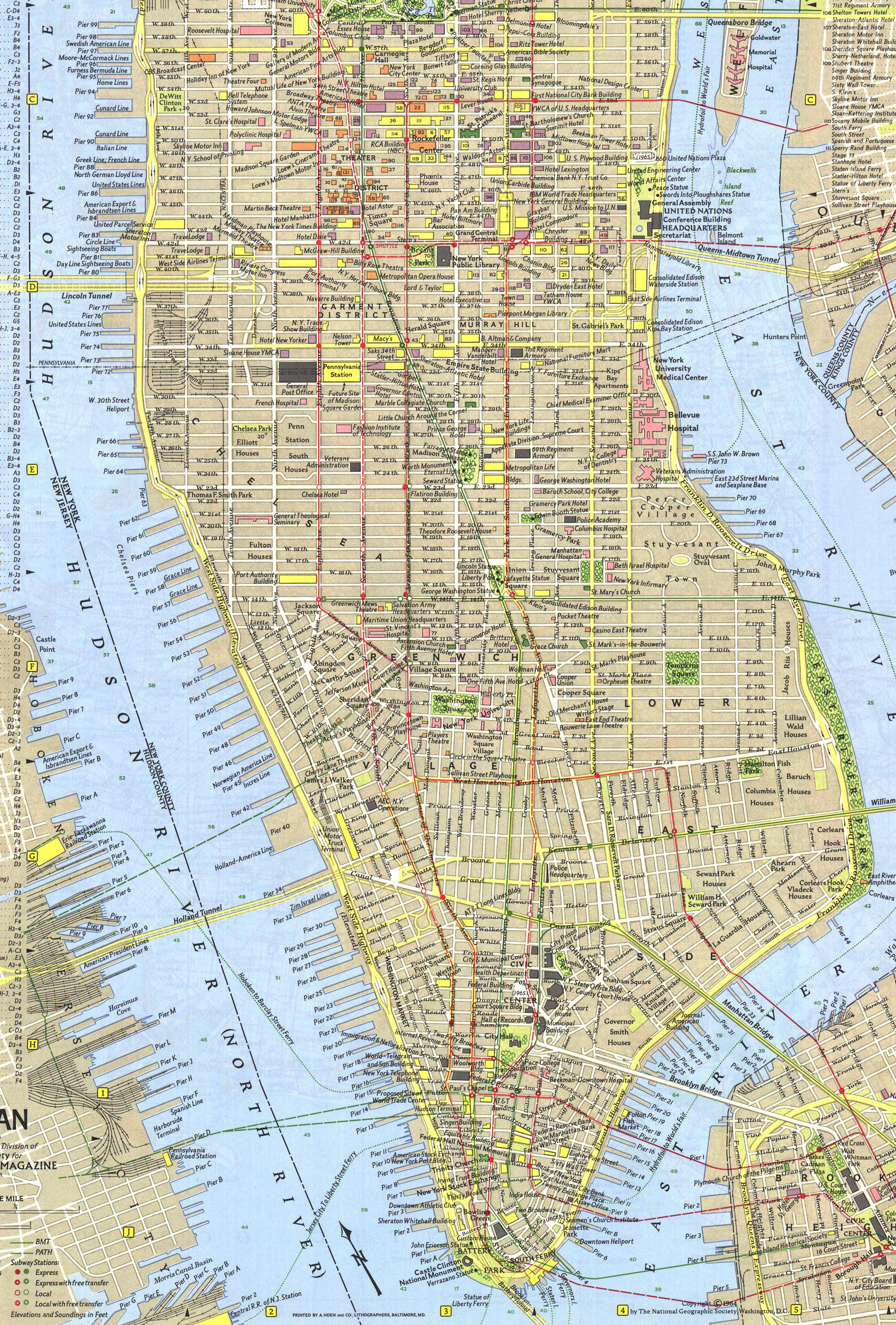
The Full Map.

Please help keep Ocean Liners Magazine afloat. Any amount will be greatly appreciated. Think of it like tipping your history steward.
—Regards, John Edwards, Editor/Publisher.
